Mrakovica is located on the Kozara Mountain, in the heart of Kozara National Park. With elevation of 806 m, it presents an aerial spa and offers great possibilities for Summer and Winter sports alike. It is also a place of great significance in WW2 and hosts a large memorial complex.
2025 Race Manual
Hello and welcome to B-HARD Ultra Race & Brevet!
Race manual version 10/June/2025
Added more details about the route, starting procedure, riders roster
Quick link to the GPX files: #gpx
Pre-event support and urgent issues during the race & brevet:
You can get in touch with me (Nikica aka Nik) via Viber, WhatsApp, SMS and voice on +38765511016, Instagram and Facebook as @cybernck and by email on bhardultrarace@gmail.com – also, please note I may be calling you from +38766906906
I will be driving the Skoda Octavia aka Ultracar – CONTROL CAR 1:
CONTROL CAR 2: Damir +38766359335

CONTROL CAR 3: Darko +38765684226
CONTROL CAR 4 & CP4 and CP9 fixed contact will be Goggy on +38765874822
Social networks
We will be posting updates on our Instagram Profile and Facebook Page via stories and posts – you can tag us as @bhardultrarace and also use hashtags #bhardultrarace and #bhard25
If you plan to have someone managing your social media while you are away – put them in touch with us, so we could provide them with content during the event.
Join our Strava Club as well! 🙂
Dot-watching
Live public GPS tracking for dotwatching is available on https://www.followmychallenge.com/live/bhard25/
The GPS trackers courtesy of FollowMyChallenge are fully charged up and you should turn them on by pressing the (very small and inconvenient) power button on the top side of the tracker for a couple of seconds, about half an hour before the race start in order for the GPS tracker to get its initial satellite lock. Blue LED blinking means the tracker is searching for location, red LED blinking means low battery status, which green LED blinking means it is transmitting data. If you don’t happen to register on the map right away at the 5 AM start or there is some other problem, we will deal with it at the start point outside the city or at CP1.
Video instructions for use: https://youtu.be/TwxAs5E3brU
Also, please note that these GPS trackers require GSM network in order to transmit data, so there might be periods when, to the dotwatchers at home, it might appear that you are not moving (although the last reported time will be noted on the tracking page as well).
We will be monitoring the battery status and in the case that you need to recharge the device, you will receive a mini-USB charging cable from the control car or at the next checkpoint.
Please keep the trackers safe and in a provided plastic bag. A lost or a damaged GPS tracker will need to be replaced at a cost of 150€.
Show us your bikes
DotWatcher.cc will be doing B-HARD introduction followed by daily updates, so a lot of people interested in the subject of ultradistance riding will be following the event. Please could you contribute to their Bikes Of B-HARD Ultra Race & Brevet article? It is a very interesting feature and helps provide a fuller understanding to those watching you race at home and gives riders for next year a great insight into what equipment to take!
You can find the instructions on taking photos of your bike and uploading it to the Dotwatcher’s Bikes Of B-HARD article here:
https://dotwatcher.cc/contribute/bikes-of/bikes-of-b-hard-ultra-race-and-brevet-2025
First things first
Firstly, you may want to turn off mobile data on your phone because the roaming charges will be way too high (unless you have a specific non-EU data plan). We will provide you with a local SIM card with a 7-day data plan upon your arrival (if you selected that option during registration). Your phone must not be SIM-locked to your local networks. Once you insert the new SIM card, in order to activate it you need to dial any number and you will receive a message that the number has been activated. After that, if data doesn’t work, you need to dial 066101010 and then select 3 in order to receive the settings file for your phone. Afterwards, install the settings and restart your phone. Et voila!
In order to continue using data after the 7-day period has surpassed or you have used up the 4 GBs, you will need to top up your card via https://mtel.ba/oec/elektronska-dopuna or by purchasing credit at almost any petrol station or store. The amount of 3 BAM will be enough to activate a further 3-day 30 GB plan by dialing *100*1*1#
Also, please note that in some areas (especially in the mountains and in the areas neighboring other countries), cell reception might be spotty, especially for the use of internet. Portion of the route between Blidinje and Široki Brijeg, as well as Bjelašnica mountain and Konjic has areas that are completely out of cell phone service.
Shops, restaurants and smaller hotels are generally open until 10 PM. Bigger hotels and bigger petrol stations are open 24/7.
If you need any help with local transportation in order to reach Banja Luka – do let us know and we’ll do our best to help you out.
Finally, as soon as you arrive and settle down, get in touch with us as we’d like to meet up with you, if it proves possible. Otherwise we’ll do a casual meet & greet on the 12th of June (Thurdsay) in the evening or we’ll see you on the 13th of June (Friday) in the afternoon (official briefing). Detailed schedule is posted below.
Accommodation in Banja Luka
We have teamed up with Hostel Herz to provide you with different options of affordable accommodation in the city center, just a few hundred meters away from the location of race briefing and start. Apart from a discount for mentioning B-HARD, you will get free secure car parking and safekeeping of your luggage while you’re away riding. You can get in touch and make your reservation on info@hostelherz.com or preferably on +38766617627 (voice, SMS, Viber, WhatsApp).
There are nearby bakeries here and here, sports nutrition shop here and a supermarket here, as well as numerous cafes and fast food shops (just Google them).
If you wish more comfort and/or want to be located literally at the start line, look into booking Hotel Zepter Palace. Alternatively, any form of accommodation in the city center will suffice.
If you’re coming with a campervan, it’s best to arrange it with Hostel Herz, as they’ve got a huge private parking lot at their disposal.
Bike shops/services can be found here, here and here.
Basic stuff
“Dobar dan” is a way to say good day or hello, “hvala” means thank you, while “voda” is water.
Also, when you happen to see “pekara”, “pekoteka” or “pekarna” – it’s a bakery with different pastries, out of which “burek” (e.g. our traditional meat pie) is always a good idea for a hungry cyclist (unless you’re a vegan, that is – then select one of the pies with vegetables).
The biggest wealth of Bosnia & Herzegovina – apart from its people and diversity – is drinking water. Tap water is safe to drink everywhere and also wherever you see a water fountain or simply a pipe coming out of a wall with water running out on a side of the road – it’s safe to drink it except if there’s a (very rare) sign specifically stating otherwise. Also, as a rule of thumb, every church and mosque will have a tap with drinking water. Of course, you will be able to fill up your bottles on every CP as well.
There’s normally a multitude of petrol stations along the way – smaller ones open during the day, big ones 24/7 – except in rural areas, mountains and where it’s specifically noted in the checkpoints presentation (down below).
The only officially accepted currency is Bosnian Mark (BAM) – KM in local language, which is fixed to Euro at 1.9558 KM for 1 EUR. You can sometime get away by offering Euros instead, in the areas neighboring other countries. Credit and debit cards are widely accepted in all main areas but for smaller towns or roadside shops and bakeries – it might prove crucial to have cash in hand.
Phone number for police is 122, fire fighters 123 and emergency services 124.
Sunrise during B-HARD will occur at 5:05h, with sunset at 20:39h, which means you will have a really long period of daylight.
From what it looks like at the moment, the weather for the warmup rides as well as the race will be perfect. Daytime temperature around 30 deg C in the flats and 19 deg C in the mountains. Night time temperatures 14 deg C and 3 deg C respectively. Some showers possible on Tuesday. If you want to try avoiding a passing shower, you may want to keep an eye on the weather radar.
Riders assembly and start location
The main location you should be aware of, where all the rides will start at, is Park Petar Kocic in the city center.
Schedule of events
– 11/June (Wednesday) at 10:00h – 85 km / 750 m Social Warm Up Ride #1
START LOCATION: https://goo.gl/maps/rwNg85qKrETdT9oL8
RWGPS MAP: https://ridewithgps.com/routes/47082005
GPX FILE: https://www.dropbox.com/scl/fi/y9z8bbgjze86km6m5dz97/B-HARD_2025_Warmup_Wednesday_-85_km.gpx?rlkey=mxw0o3u4g1cf0pidkgr5ybuxc&dl=0
– 12/June (Thursday) at 10:00h – 80 km / 870 m Social Warm Up Ride #2
START LOCATION: https://goo.gl/maps/rwNg85qKrETdT9oL8
RWGPS MAP: https://ridewithgps.com/routes/47082091
GPX FILE: https://www.dropbox.com/scl/fi/mnqaqglt9tu5xc4dw4gvo/B-HARD_2025_Warmup_Thursday_-80_km.gpx?rlkey=wk4qhlric2r3yg7p8f69l4o8k&dl=0
– 12/June (Thursday) from 18:00h to 20:30h – casual meet & greet, starting packs & bike checks at our HQ
LOCATION: https://www.google.com/search?q=44.774997801417285%2C+17.185264471492548
– 13/June (Friday) at 10:00h – 55 km / 300 m – OFFICIAL WARM UP RIDE
START LOCATION: https://goo.gl/maps/rwNg85qKrETdT9oL8
RWGPS MAP: https://ridewithgps.com/routes/51093440
GPX FILE: https://www.dropbox.com/scl/fi/3nuawhh07kgg0ubainecu/B-HARD_2025_Warmup_Friday_-52_km.gpx?rlkey=cba7549gwfe90jcuqi2mmzf09&dl=0
– 13/June (Friday) from 16:00h to 18:00h – EVENT BRIEFING, starting packs & bike checks
LOCATION: https://www.google.com/search?q=44.768693132368945%2C+17.190910548936742
– 14/June (Saturday) from 4:00h – rider gathering with THE START of the neutralised group ride by 4:30h
START LOCATION: https://goo.gl/maps/rwNg85qKrETdT9oL8
RWGPS MAP: https://ridewithgps.com/routes/51092879
GPX FILE: https://www.dropbox.com/scl/fi/xqf2beravk1ykl447cxp2/B-HARD_2025_Pre-Start_Warmup_-9_km.gpx?rlkey=4zj4hs4y7sbdfdmia7ujcjqud&dl=0
– 14/June (Saturday) at 5:00h – THE OFFICIAL START
START LOCATION: https://maps.app.goo.gl/UeSNtPztXTdBoRNV6
– 14/June (Saturday) at 18:30h – TIME LIMIT for B-200 riders (13h30)
https://goo.gl/maps/rwNg85qKrETdT9oL8
– 15/June (Sunday) at 1:00h – TIME LIMIT for B-300 riders (20h)
https://goo.gl/maps/rwNg85qKrETdT9oL8
– 15/June (Sunday) at 21:00h – TIME LIMIT for B-600 BRM riders (40h)
https://goo.gl/maps/rwNg85qKrETdT9oL8
– 17/June (Tuesday) at 23:00h – TIME LIMIT for a successfully completed 1200 km RACE (90h)
– 18/June (Wednesday) at 0:30h – TIME LIMIT for a successfully completed 1200 km LRM (91:30h)
https://goo.gl/maps/rwNg85qKrETdT9oL8
– 18/June (Wednesday) at 11:00h – rider gathering and DEBRIEFING at our HQ
https://www.google.com/search?q=44.774997801417285%2C+17.185264471492548
– 18-21/June – Ultrapool, recovery rides etc.
Riding in Bosnia & Herzegovina
If you happen to come from countries with severely developed cycling infrastructure, you may find it a bit intimidating (at first anyway) that cyclists here ride on main roads along with all other forms of traffic. Furthermore, most of the roads don’t contain hard shoulders (e.g. additional space on a side of the road) but in fact the law allows you to use a meter wide strip of the road, with cars supposed to slow down and pass you with 1.5 meters to spare. Usually this is the case but sometimes you may encounter inexperienced or simply rude driver speeding past you, passing you too close or doing overtaking coming towards you, which is why you always need to have some space on the right hand side to move over in these situations. If you simply ride on the very edge on the road, then you can expect this to happen to you all the time.
Since it is very important to always be aware of what’s going on ahead and behind you and keeping your stance on the road i.e. “ride defensively” as I like to say, it is prohibited to use headphones (especially in the left ear) and also to ride without helmet or with both hands off the handlebar at the same time. These events will trigger a warning, followed by 3h of time penalty. Blasting through a stop sign or jumping a red light is naturally dangerous and prohibited whichever way you look at it and thus it will also trigger a 3h time penalty.
Some drivers might honk their horn in order to warn you they are approaching and others might honk as they are annoyed with having you on the road to begin with. There are many riders that might honk or wave at you to say hello and support you, so it all balances out, so to speak. Still, if you don’t know which of this is the case, it’s best to simply ignore it.
Most of the roads we’ll be using are quiet enough for you to enjoy the ride (especially on Saturday and Sunday). The busiest sections will be bigger cities, like Mostar and Sarajevo as well as portions of route leading to them and leaving them. Using smaller roads usually means that some of the roads are narrow or not maintained well, therefore it’s possible to come across random potholes, sand or rocks on the road surface, therefore please be very careful, especially on the descends. Critical sections will be noted in the checkpoint review below.
Stray dogs are not a big issue is Bosnia & Herzegovina. You may encounter a domestic or a shepherd dog that might chase you and bark at you defending their territory but this was a random and seldom occurrence during past editions of B-HARD and depends from case to case really. The main strategies include shouting at the dog, speeding up for a few seconds, spraying the dog with water or – if the situation dictates – dismounting from the bike and walking past the dog in question.
Wild camping out of sight and on non-private grounds is not prohibited by law to the best of our knowledge but of course police will not really condone a tent raised in a city park or someone laying on a side of the road.
Riding three or four consecutive days in (presumably) bright sun might take its toll on your skin, so bring some sun block with you, stay hydrated and regularly eat.
In addition to your summer cycling outfit, I would recommend adding another set of it, plus arm warmers, leg warmers, windproof vest, thermal jacket and long-finger gloves – and you’re set for all weather conditions. On top of that, you’ll need hi-vis vest for night riding, a good set of lights of definitely a power bank.
Do not litter, be polite, take lots of photos and videos and enjoy the ride!
Different categories
The actual ride in all thee race and brevet categories is of unsupported type, which means you need to carry all of your gear and you are not allowed to have 3rd party assistance, other than between the riders themselves in the brevet category and obviously in the race pairs category but only between the two riders. However, it is also allowed to get help from the organisers at the CPs or from control cars on the route, should there be an emergency.
B-RACE is a single-stage non-stop self-supported cycling ultramarathon (or shorter: ultra race), which follows a fixed 1217 km asphalt route on roads not closed for traffic (which assumes following all road traffic rules and regulations, including the use of helmet) with obligatory time controls at designated checkpoints. The type of riding is basically individual time-trial (no drafting allowed, except in pairs category) and no 3rd-party outside assistance is permitted, other than that provided by the organiser and commercially available services. Deviation from the route is allowed for purposes of sightseeing, accommodation and similar but the ride needs to resume from the point where the rider had left the route. The time limit is 90 hours.
In B-RACE category, there’s a classification at the finish and a winner but there are also different sub-categories such as fastest female rider, Race Across America Qualifications, the fastest rider aged 50 and above, fastest rider under 30 years old, Balkan King award and Michelin Superhero award. All this comes with a 90 hour time limit for a successful finish, although you will be considered a route finisher even if you finish in a bit outside of the time limit (OTL). In order to qualify for RAAM, you need to complete the route in under 84 hours.
B-PAIR is essentially the same thing as B-RACE but it’s done in pairs. Riders in the pairs category need to start together, appear at the CPs together and finish together. All other B-RACE rules apply here as well. There’s classification at the finish line and a winner but no other sub-categories or qualifications for RAAM. The time limit is 90 hours.
B-1200 is an LRM1200 brevet – an official LRM sanctioned event and it follows the same 1220 km route as the race. The type of riding complies with all LRM regulations (drafting is allowed) and no 3rd-party outside assistance is permitted, other than that provided by the organiser and commercially available services. Deviation from the route is allowed for purposes of sightseeing, accommodation and similar but the ride needs to resume from the point where the rider had left the route. The time limit is 91 hours and 30 minutes for purposes of homologation, although you should aim for the original 90h time limit of the B-HARD challenge for maximum pleasure 🙂
B-600 is a BRM600 brevet – an official BRM sanctioned event and it follows the main B-HARD route to CP4 MOSTAR, where it branches out shortly, only to rejoin the B-HARD route 50 km down the road and visits CP10 VLASIC afterwards. The type of riding complies with all BRM regulations (drafting is allowed) and no 3rd-party outside assistance is permitted, other than that provided by the organiser and commercially available services. Deviation from the route is allowed for purposes of sightseeing, accommodation and similar but the ride needs to resume from the point where the rider had left the route. The time limit is 40 hours.
B-300 and B-200 are non-homologated brevet events which again allow drafting and go along the rules of the previous two categories as well. There are no time limits per se.
B-WOMEN is a special promotional ride only for female riders that follow the B-HARD route for the first 100 km via CP1 KOZARA and then later branches off to Banja Luka (total of 120 km).
B-TOUR is a special fully-supported ride package for individuals and small groups and is designed for road cycling enthusiasts who are not really into full-on ultracycling but still want to have an amazing cycling experience and explore our country. Riders of B-TOUR will ride about 650 kms of the route in 4 stages, being shuttled between certain checkpoints. It is not allowed to mix and draft with these riders.
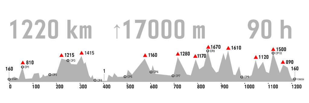
B-HARD – 1220 km / 17000m (time limit 90h for RACE, 91:30 for LRM)
The roads are a mixture of main, regional and local roads, completely surfaced with asphalt (save for any eventual roadworks on the route). The condition of the surface ranges widely – from brand new to extremely broken and patched up. Comfort is a relative term in the case of ultradistance cycling but 28 mm tyres are perfectly fine for the job. Many riders have completed the route without issues even on 23 or 25 mm tyres, while some prefer 32 mm or larger tyres, which can only be more comfortable while not being significantly slower. The roads in Bosnia & Herzegovina are generally not too busy traffic-wise, except the urban area of Sarajevo and Mostar. However some roads are narrow and generally in Bosnia & Herzegovina there is no “hard shoulder” for cyclists to ride on, e.g. you share the road with other traffic (as mentioned previously).
The country is quite hilly, as you may have figured out yourself by now, so there are lots of tunnels throughout the route, the longest one being a 2100 m long modern tunnel with lighting and sidewalks between CP5 and CP6 and a series of 39 consecutive tunnels (some short, some long and usually lit) approaching CP7. It is obligatory to go into “night mode” riding through the aforementioned sections, regardless of the time of day you happen to reach them. Of course, it’s advisable to use common sense and keep track of what’s going on behind you prior to entering any of the tunnels.
Also, while there’s normally no shortage of petrol stations and cafes along the main roads, except in the rural mountain areas, there’s a 100 km portion of the route between CP4 and CP5, specifically between Čapljina and Trebinje, that follows the famous Ćiro Bike Trail – an old narrow gauge railway converted to a (bumpy) public road and a marked cycling route. This portion of the route offers virtually no restocking options except a very nice hotel/restaurant in Ravno, as an oasis at about halfway of the aforementioned section. Also, this section might be quite intimidating if riding alone at night while it offers very nice views during daytime.
 1200 RideWithGPS route: https://ridewithgps.com/routes/50867285
1200 GPX track file: https://www.dropbox.com/scl/fi/ueulffffqcq82foj0a2a0/B-HARD_2025_-1220_km-_FINAL.gpx?rlkey=00gz4ffm8zwwzggd7s2hjekpw&dl=0
1200 FIT file: https://www.dropbox.com/scl/fi/9cfdj7tp43c2cv2btnwu6/B-HARD_2025_-1220_km-_FINAL.fit?rlkey=z13udoxe5wwmm2tnzdqln5i3p&dl=0
1200 segmented GPX files (CP-to-CP): https://www.dropbox.com/scl/fo/uv3k9dycn6cqedkctfwhz/AMd0IGGEJF9YOaquY0v8Lx4?rlkey=1vpqqbycnoz2ihpkvlyrrsnun&dl=0
B-600 – 620 km / 7250m (time limit 40h)
The route follows the main B-HARD route via CP1 KOZARA, CP2 JAJCE and CP3 KUPRES to CP4 MOSTAR, where the B-600 route splits off of the main B-HARD route, only to join it again 50 km down the road at the town of Jablanica. Then you continue following the main route to CP10 VLASIC and onward to Banja Luka.
Note: CP10 will open at 8 AM on 15th of June, so if you get there during the night, there will be no service.
B-600 RideWithGPS route: https://ridewithgps.com/routes/51057097
B-600 GPX track file: https://www.dropbox.com/scl/fi/55j114zpeyi6jvazrsabd/B-HARD_2025_B-600_-620_km-_FINAL.gpx?rlkey=nqwtd4m03ogtjkjgvocaxeg0s&dl=0
B-600 FIT file: https://www.dropbox.com/scl/fi/5g6gg1ne2etbz5go8ys9r/B-HARD_2025_B-600_-620_km-_FINAL.fit?rlkey=4dbakb2qhsrxjt9y3mbqffym7&dl=0
B-600 segmented GPX files (CP-to-CP): https://www.dropbox.com/scl/fo/7r3cormwvchd1lw8tpuut/AMCy1kRAPUOyq_ONAmff3I0?rlkey=gvbgvyrlbpz4wjslskb77491g&dl=0
B-300 – 306 km / 3800 m (20h time limit)
The route follows the main B-HARD route via CP1 KOZARA to CP2 JAJCE and a little bit further to 191st km where you will turn off of the B-HARD route. The rest of the route doesn’t contain any checkpoints. In fact, you won’t have a brevet card to validate, so you can simply enjoy the ride. The finish is at the same location as the starting point.
B-300 RideWithGPS route: https://ridewithgps.com/routes/47025969
B-300 GPX track file: https://www.dropbox.com/scl/fi/mrl0sqqh9mse95xdrrqa8/B-HARD_2025_B-300_-306_km-_FINAL.gpx?rlkey=va208qvno9otft2t4of3vbltv&dl=0
B-300 FIT file: https://www.dropbox.com/scl/fi/pp532i32s1mjvrzzqspr5/B-HARD_2025_B-300_-306_km-_FINAL.fit?rlkey=1a264j37d955w8h48rv1qleae&dl=0
B-200 – 196 km / 2370 m (13:30h time limit)
The route follows the main B-HARD route to CP1 KOZARA, then continues on to 147 km – petrol station on top of Dabrac climb, where the route turns around. The rest of the route doesn’t contain any checkpoints. In fact, you won’t have a brevet card to validate, so you can simply enjoy the ride. The finish is at the same location as the starting point.
B-200 RideWithGPS route: https://ridewithgps.com/routes/47026048
B-200 GPX track file: https://www.dropbox.com/scl/fi/ih7p4xscda6tf8qh54urm/B-HARD_2025_B-200_-196_km-_FINAL.gpx?rlkey=y4uufyb3rhekworh8eh78gw5x&dl=0
B-200 FIT file: https://www.dropbox.com/scl/fi/0xkh239hny5qkycabhmkx/B-HARD_2025_B-200_-196_km-_FINAL.fit?rlkey=hqd701kk8mteqs8q5i3id61td&dl=0
B-WOMEN – 120 km route
The route follows the main B-HARD route to CP1 KOZARA, then continues on to 100th km, where it leaves the B-HARD route and continues straight on to Banja Luka. The finish is at the same location as the starting point.
B-WOMEN RideWithGPS route: https://ridewithgps.com/routes/47126894
B-WOMEN GPX track file: https://www.dropbox.com/scl/fi/13d036gaxofotp7i4bho7/B-HARD_2025_B-WOMEN_-117_km-_FINAL.gpx?rlkey=yj29ziiljm24bqdkv2hm5ipil&dl=0
B-WOMEN FIT file: https://www.dropbox.com/scl/fi/j3wlcpdoxr7mlhbjhtwso/B-HARD_2025_B-WOMEN_-117_km-_FINAL.fit?rlkey=u715ntvuk1arjutoo5zwevvz0&dl=0
DOWNLOADABLE ARCHIVE OF ALL THE ROUTES:
https://www.dropbox.com/scl/fi/2ecmrfponbg6d3mufr9z0/B-HARD-2025-GPX.zip?rlkey=57bk1umsdlqa48r0fdid1qkhg&dl=0
Starting procedure
As you (should) know, we gather at the city park from 4:00h, while the start of the neutralised group ride will happen by 4:30h and we’ll ride together to the exit from the city to the official starting location, where we’ll have a short stop to differentiate the categories and to start the actual timing at 5:00 B-WOMEN riders will continue the ride almost straight away, followed by B-200, B-300, B-600 and B-1200 brevet riders with roughly 30-60 s of delay in-between the categories.
The Ultra Race riders are starting individually at 20 sec interval, a minute behind the last of the brevet categories, with the B-PAIR category starting first, followed by the solo riders. The start list is determined by the date of registration (sorted from early to late), with the exception that we have decided to line up the female riders at the front of the grid.
To expedite the starting procedure, please form the starting grid as follows (front to back):
B-WOMEN riders
B-200 & B-300 riders
B-600 riders
B01 to B09
B10 to B19
B20 to B25
B-PAIR riders
Female racers
R01 to R09
R10 to R19
R20 to R29
R30 to R39
R40 to R49
R50 to R59
To jump to the final start list, please click here.
CHECKPOINTS
In order to complete the course successfully, riders from all categories are required to stop at all the designated checkpoints and have their card stamped and time of arrival noted (except for the categories that don’t have physical cards). In case that the checkpoint is closed or there’s some other obstacle that arises, we’ll still have you electronically checked in via GPS tracking.
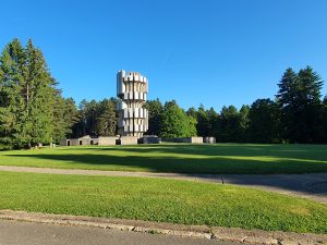
CP1 50 km – KOZARA – Monument – Googlemaps location
CP1 perhaps comes in only at 5oth kilometer of the route but it is situated on top of a 800 m high mountain, requiring you to do a 12 km climb @ 5% average gradient. After refreshments in the heart of the National Park, at the base of a WW2 monument, you are greeted with a descent along the same road and shortly afterwards the roller-coaster ride begins.
Your brevet card will be stamped by the volunteers at the base of the monument, where you will also be provided with the refreshments.
From then on – there’s a bakery at the base of the climb. Also, there’s a water fountain at the beginning and on the middle of the climb and also drinking water and toilets at the checkpoint. Later down the route towards CP1, the next major resupply points are at 87 km (church with a water fountain and a small shop), Krupa na Vrbasu at 131 km (a store and a petrol station) and Dabrac at 147 km (petrol station). There’s a nice water fountain at 158 km and a few more petrol stations just before CP2. Also, please take a moment to admire the wonderful view of “Vrbas snake” gorge at 146 km.
ATTENTION: Be careful going downhill from CP1 as there might be loose rocks on the road and especially as other riders might still be going uphill. Also, the descend at about 128 km of the route can be very tricky, so please take it easy, especially as it abruptly joins the main road at the very bottom of the descent.
CP2 169 km – JAJCE – Tourist Info Center – Googlemaps location
Jajce is a wonderful town in central Bosnia, rich of culture, history and natural beauty. The town is famous for its beautiful 22-metre high Pliva River waterfall, medieval fortified city, nearby lakes, traditional watermills, fish farming, sports & recreation.
After a picturesque rolling terrain section, you will drop down to the stunning Vrbas River canyon and follow it all the way up to CP2 in Jajce, where Pliva River convolutes with Vrbas River in form of a magnificent waterfall. Prior to the said waterfall, Pliva River forms several lakes and cascades, all of which you will be able to see and experience on your way out of Jajce.
The staff at the Tourist Info Center will stamp your card and provide refreshments.
From them on – resupply options in form of shops and petrol stations available at Šipovo (197 km) and Strojice (212 km), with a water fountain roughly half-way up the climb inbetween these two points.
ATTENTION: The road along the lakes leading out of Jajce is in bad condition, pay attention to potholes and sewer grids and there’s a roundabout under construction, with about 100 m of gravel.
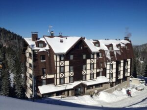
CP3 236 km – KUPRES – Hotel Kupres – Googlemaps location
Kupres is a town in Dinaric Alps at 1180 m above sea-level, surrounded by mountain peaks, which makes it a famous ski resort but it also boasts active tourism like motocross, paragliding, horse-riding, mountain biking and off-road driving. It is also known for a large natural lake and medieval tombstones.
After leaving Jajce, you will be following the clear waters of Pliva River upstream, almost all the way to its spring. This will give you a chance to relax and get back into rhythm. Once you reach the locality of Janjske Otoke River delta, you will start gaining altitude (e.g. climb!) for the best part of the next 18 km, to finally reach a 1200 m high plateau of Kupres, which hosts CP3.
Hotel Kupres is hard to miss as it is bang on the route. The staff will stamp your brevet card and provide you with refreshments for the rest of the trip. This is also a very convenient location to have a lunch at.
From them on – petrol stations available in Kupres (238 km), Šuica (256 km) and Mandino Selo (279 km) but from then on there might not be resupply options until Široki Brijeg (342 km), unless you go a bit off the course in Rakitno (312 km).
ATTENTION: From CP3 to CP4, specifically from 312 km to 342 km, you will be riding on a narrow twisty road, often with loose rocks on the road. Also, while this portion of the road contains mostly brand new asphalt, the first three kilometers of the descend towards Široki Brijeg is old twisty broken up asphalt, starting with a huge pothole, so beware!
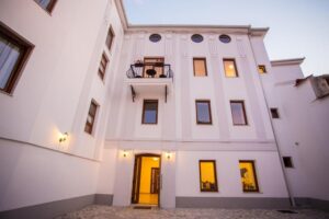
CP4 366 km – MOSTAR – Hotel Hana – Googlemaps location
Mostar is a city of flowers and greenery. Its charm rests in its streets interwoven with the spirit of many different civilizations which have dwelled here. Situated only 60 km away from the seaside, Mostar has a pleasant Mediterranean climate. In the city itself and in its vicinity there are many unique locations with historical and cultural treasures, the most prominent being the Old Bridge, which joins the left and the right bank of the Herzegovinian pearl – the river Neretva.
Even-though you’re required to ride over 130 km in order to reach CP4 after leaving CP3, the road cascades from 1180 m/alt all the way down to just 40 m/alt, albeit with a 1415 m high climb in between, so it will be a relatively easy end to a day, especially as you’ll be greeted with a sight of a UNESCO World Heritage site, that the elegant Mostar’s Old Bridge is! Mostar also marks a location that will be quite convenient to seek accommodation at, providing you’ve split the route to 4-days of riding.
The checkpoint is located at the hotel. The staff will stamp your brevet card and provide you with refreshments for the rest of the trip.
ACCOMMODATION INFO: Hotel Hana – the actual CP / hotelhanamostar@gmail.com / +38763408055
24/7 reception, double and triple rooms, big apartments, prices around 27-33€ per person
ATTENTION: From Mostar to Trebinje you will be riding partially on Ćiro trail – an old railway converted to a road, with questionable road surface and almost no resupply points. The last proper resupply point will be at the town of Čapljina (400 km). The town of Ravno (458 km) features Hotel Stanica, with accommodation and restaurant but it might not be operational during night time. Going out of Ravno, there are some unavoidable road works (although should not be active during Saturday night and Sunday morning, so you will be required to take a 2200 m gravel bypass. The only water fountain can be found near the church in Mrkonjići (474 km).
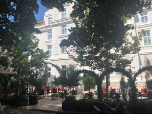
CP5 503 km – TREBINJE – Hotel Central Park – Googlemaps location
Trebinje is located in the southernmost part of Republic of Srpska and Bosnia and Herzegovina. It features Mediterranean climate with 260 sunny days, old town quarter and bridges from 18th century, great number of religious objects from various time periods and The City of Sun aqua park.
Going out of Mostar, you’ll generally be riding on an old Vienna to Dubrovnik railroad route, now-days a well known paved cycling route popularly named after the Ćiro train. The first 50 kilometers of the route are pretty flat, after which you’ll be greeted by a 10 km climb with spectacular views over Hutovo blato Nature Reserve. The town of Ravno, previously one of the main train stations, now presents an oasis for cyclists on the Ćiro route. After some more flat road riding on a main road, you will reach CP5 in the heart of beautiful city of Trebinje.
The checkpoint is at the Hotel Central Park where a receptionist or a volunteer will stamp your card and provide you with a snack.
ACCOMMODATION INFO: Hotel Central Park – the actual CP / info@hotel-centralpark.com / +38759490850 / or several others on Booking.com. Trebinje will be very busy and this particular hotel doesn’t have any available rooms at the time of writing this, so do plan ahead. Alternative location for accommodation is just before Trebinje at Grad Sunca (requires a 2 km detour one way from the main route at 498 km).
From then on – going out of Trebinje, the next resupply point will be at Bileća (531 km) and Gacko (requires a 2 km detour one way from the main route at 574 km), though options for resupply at both locations will be questionable during night time, so you will have to stock up back in Trebinje.
ATTENTION: There will be a moto fest taking place in Trebinje on Saturday evening, so it will be very busy and loud. The road from Trebinje to Sutjeska is a main road and – although not too busy – it’s a bit narrow and motorists are not really used to come across cyclists there. Also, during Sunday you will be passed by hundreds of motorcycles going back from the moto fest in Trebinje. There’s a 2100 m long tunnel on the approach to the National Park Sutjeska. It’s lit and with sidewalks but you should still go into night mode and turn on your lights. After a tunnel, there is a landslide and the road narrows to a single lane at a certain point. The descent into the Sutjeska river valley is extremely fast, so tackle it with care.
CP6 610 km – SUTJESKA – Restaurant Tentorium – Googlemaps location
National Park Sutjeska is the oldest and largest national park in Bosnia & Herzegovina, which is by its natural values and beauties the pearl of B&H and features one of the last remaining primeval forests in Europe. Tjentište in the Valley of Heroes is a home to the WW2 Battle of Sutjeska memorial complex.
Straight out of Trebinje, you’ll be greeted with a 6 km climb @ 5 % and then, after some rolling terrain along side a large artificial lake, you gradually continue climbing for the next 50 km as well! A short downhill section to catch your breath will be handy because the beauty of the National Park will take it away again. You’ll be glad to have reached CP6 in more ways than one, as it marks the half-way of the route and also makes for a great spot to restock your belly on tasty calories.
The checkpoint is at Restaurant Tentorium where you’ll get your card stamped by staff or volunteers, from 7:00h to 22:00h. There should also be some complimentary refreshments available. However, if you’re too early or too late to the checkpoint, you will get electronically checked in by GPS.
From then on – you will be joining a main road, with a plethora of accommodation and resupply options, most notably at Foča (632 km), Ustikolina (643 km), Goražde (665 km) and Ustiprača (676 km).
ACCOMODATION INFO (might be closed during race days): Hotel Mladost – a couple of kilometers before the CP / office@sutjeskanp.com / +38758233130
24/7 reception, double and triple rooms – prices around 27€ per person
ATTENTION: On the descent going out of Sutjeska, the road surface is very sketchy and uneven, so please take special care. After the descent, you will join the main road with a bit more traffic than the preceding portion of the route, that will also take you through 39 tunnels towards Višegrad. Most of them are short or lit but you still need to be in the “night mode” going through the tunnels and always glance what’s going on behind you before entering a tunnel, just for precaution.
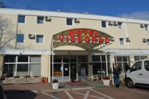
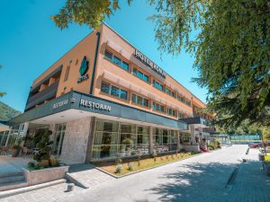
CP7 705 km – VIŠEGRAD – Hotel Višegrad – Googlemaps location
Višegrad is located at the confluence of the Drina and Rzav rivers in Eastern RS and B&H. The town includes the Mehmed Paša Sokolović Bridge, a UNESCO World Heritage Site which was popularized by Ivo Andrić in his novel The Bridge on the Drina. There’s a tourist site called Andrićgrad is located near the bridge.
Save for a 5.5 km climb @ 4.5%, followed by a similar descent, leading out of the Sutjeska National Park, this portion of the route follows a lush green Drina River downstream, so it is mostly flat and scenic. Also, the very last portion of the route takes you through a canyon and passes through 39 tunnels, before a UNESCO World Heritage site suddenly appears before you!
You will get your card stamped at the reception of the hotel and you should also be greeted with some refreshments for the rest of the trip or for your nightly stay. Speaking of accommodation, you will have an option of staying at very affordable rooms.
ACCOMMODATION INFO: Hotel Višegrad / the actual CP / hotelvisegradrecepcija@gmail.com / +38758620710
24/7 reception – single and double rooms, from 25€ to 30€, take-a-way breakfast +5€
Restaurant open from 7 AM to 11 PM
Alternative CP7 accommodation:
Hotel Andrićgrad – a few hundred meters away from the CP / andricgradinfo@gmail.com / +38766703722
Reception open from 7 AM to 11 PM – booking and contact obligatory to obtain entry during night time
Double, triple and quadruple rooms from 16€ to 26€
From then on – resupply and lodging options (questionable during night time) are Rogatica (750 km – the town center is 500 m away from the route), Goražde (778 km) and Podgrab (825 km), with a water fountain at a few locations on the climb after Goražde (notably at 1000 m of elevation, at the top of the climb and even somewhere in between).
ATTENTION: Even though we make best efforts to notify the owners, there might be some shepherd dogs on the loose, on the climb up from Višegrad (check the last paragraph of the race manual for more details). There are speed bumps on the descent going into the town of Rogatica. Asphalt on the climb out of Goražde is very patchy and broken up, while the descent on the other side is narrow, zig-zagging and often with scattered rocks, so please be extremely careful. Last few kms to the top of Jahorina are also pretty bad and one of the steepest section of the route.
CP8 850 km – JAHORINA – Hotel Lavina – Googlemaps location
Jahorina is a mountain and ski resort located near the municipality of Pale, Sarajevo. Part of the Dinaric Alps, it has a summit elevation of 1916 meters and presents the highest point of B-HARD Ultra Race route. Jahorina hosted the Women’s alpine skiing events of the 1984 Winter Olympics and 2019 EYOF.
Road to CP8 will definitely separate men from the boys. Straight out of Višegrad you need to tackle a 17 km climb with 50 bends and over 1000 m of elevation gain, then, a bit later on, a 21 km climb up to 1170 m/alt awaits you, followed by a hairpin-riddled downhill section. Only then will you be presented with a 16 km climb up to Cima Coppi of the route @ 1670 m, with a very steep last km. You will be very glad to have reached CP8 and enjoy a refreshment at Hotel Lavina (Avalanche :)).
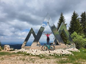
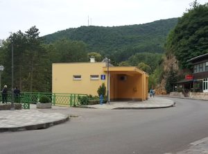
Make sure to actually reach the end of asphalt first – which is the actual electronic checkpoint – with a huge Strava-logo-looking sculpture overlooking the valley that you’ve just come from (photo above), prior to descending a couple of hundred meters to the hotel, as not to incur a penalty of 3 hours.
You will get your card stamped at the reception of the hotel and you should also be greeted with some snacks for the rest of the trip or for your nightly stay.
ACCOMMODATION INFO: Hotel Lavina – the actual CP / reservations@lavina.ba / +38766010723
24/7 reception, double rooms, prices from 27€ to 37€ per person
Restaurant open from 7 AM to 11 PM
From then on – the section of the route towards CP9 Konjic is riddled with resupply options, especially through the city of Sarajevo. After that point, virtually the only resupply options may be on Bjelašnica (911 km), followed by a small store in Glavatičevo (963 km) but only during daytime, so your best bet is to stock up in Sarajevo! There are numerous water fountains on the big descent on the other side of the Visočica mountain towards Glavatičevo, but they might be difficult to spot blasting downhill, especially during the night. If you need technical assistance, there’s a bike shop bang on the route at 887 km.
ATTENTION: The road towards Sarajevo is quite busy and contains a few tunnels. Going through Sarajevo, in the old part of the city, stick to the left hand side of the road to avoid dangerous tram lines (it’s a one-way street), while in the main boulevard make use of cycling lanes on the sidewalk! There might be a self-service vending machine available in front of Hotel Han (on the top of Bjelašnica mountain – you might need BAM coins in order to use it), where you can also get accommodation for the night. After that, you’ll be going over a 1610 m mountain pass and it’s a proper wilderness without resupply points and even without cell phone reception, so please give it some thought before you attempt to do it at night time or in foul weather. The descent is twisty and narrow, with a kilometer of really bad road through a village at 945 km and some uneven road surface further down the descent. Also, this portion of the roads contains some sections under road works (e.g. might have gravel sections).
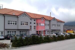
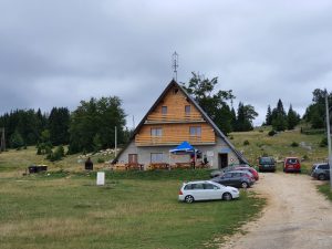
CP9 990 km – KONJIC – Hotel Garden City – Googlemaps location
Konjic is exactly where it should be, in the heart of Bosnia and Herzegovina, close enough to the South, North, East and West! Konjic is characterized by numerous tourist potentials, among which the center of tourist offer are Boračko and Jablaničko Lake, the valley of the river Neretva, the mountains Prenj, Bjelašnica and Visočica, as well as numerous cultural and historical attractions. Among other things, the Old bridge in city core of Konjic is a symbol of this city and the wider Herzegovina region.
The drop from Jahorina will take you to Sarajevo, the capital of Bosnia & Herzegovina, after some 30 kms of descending. After a blast through the flat and buzzing city center, you will climb the Olympic Mountain of Bjelašnica for almost 20 km @ 5.5% avg, followed by a short descend and then a 5 km steep climb up to the highest asphalted pass in Bosnia, at 1610 m/elev on Mount Visočica. CP9 located in Konjic awaits you in the valley on the other side of the mountain, after a significantly long descent, interrupted “only” by yet another 10 km climb. After all these climbs, Konjic will present a perfect location for a proper night’s rest.
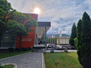
Between 9:00h and 21:00h – when you go through the gates, turn to the right and take a walkway towards a separate building where the checkpoint will be located (picture above).
Between 21:00h and 9:00h – go to the hotel’s reception (in the photo above), which is on the left hand side, after you’ve gone through the said gates.
A volunteer or a staff at the location will stamp your brevet card and provide you with a refreshment. Also, in-between the two buildings, there’s a cafe bar and a self-service coffee machine. The hotel also features a restaurant. As this is a particularly convenient location to spend a night at, we have teamed up with the hotel to provide you with discounted options of accommodation.
ACCOMMODATION INFO: Hotel Garden City – the actual CP / recepcija@gardencity.ba / +38736712800
24/7 reception, single and double rooms, big apartments, prices from 32€ to 62€ per person (quote B-HARD), including packed lunch
Restaurant open from 7 AM to 11 PM
Although they have really nice lawns and gardens, camping is prohibited 🙂
From then on – the next resupply options are Jablanica (1014 km), Prozor (1044 km), Gornji Vakuf (1064 km) and Travnik (1110 km) and a water fountain approx. on the third of the way up to Vlašić mountain.
ATTENTION: Going out of Konjic you will be joining a busy main road (at least up to Jablanica) and there are also a few tunnels on the route. The big descent towards Travnik (the one prior to the big ascent to Vlašić) is broken up in certain sections and there are some speed bumps inconveniently placed on a very fast section of the descent through a village, so keep your eyes open and your hands on the brake hoods! A short and steep descent to Travnik itself has got a sharp corner.
CP10 1127 km (527 km for B-600 riders) – VLAŠIĆ – Mountain Hut – Googlemaps location
Vlašić is a mountain in geographical center of Bosnia and Herzegovina. It is famous for its pastures, cattle-breeding and cheese. It is closest to the town of Travnik, which it overlooks. The mountain is a major center for winter tourism and it is also a popular destination for summer and eco tourism with many hiking trails and undisturbed wilderness areas. A viewpoint from Galica pass provides a spectacular view towards the valley.
The grueling and twisty 14.5 km climb up to 1500 m/alt (avg of 6.7% with some steep ramps) starts right away by leaving the city of Travnik and presents the penultimate climb on the route. CP10 is located on the very top of the climb and it’s a rather pleasant and convenient location for refreshments and short recovery. However, in order to reach Travnik going out of Konjic in the first place, you’ll need to tackle a couple of lengthy mountain passes, at 1120 and 1030 m of altitude, respectively.
The staff will stamp your card and provide refreshments, unless you maybe happen to arrive deep into the night. It’s also possible to get accommodation there, should you find it required. Just across the checkpoint, you can walk or ride for 100 meters over the grass to be greeted with a marvelous view, overlooking the valley and the road that you’ve just climbed.
Notes: For the B-600 riders, the CP opens no sooner than 15th of June at 8 AM. From then on, the CP should remain open/manned until the 17th in the evening. Further resupply options (at least during daytime) are Restaurant Kanjon (1161 km), Kneževo (1169 km) and Karanovac (1207 km).
ATTENTION: Be careful on the way down the other side of the mountain, as the road surface is frankly horrible (exaggerated with over 1100 kms in the saddle already and the fact you can gain a lot of momentum going downhill there) and with holes and sand on the road, so please be extremely careful. In fact, you should treat the whole route until Kneževo (at 1169 km) as quite dangerous. From then on, aside a few narrow points due to landslides, there has recently been a lot of new asphalt laid down.
FINISH 1217 km – BANJA LUKA – Googlemaps location
From CP10 to the finish there’s only 90 kms of distance but – you’ve guessed it right – there’s another climb in-between your location and the finish line. However, standing at only 890 m of altitude, you could say that it’s quite insignificant compared to everything you’ve experienced so far! The last 10 kms of the route are quite flat (pay attention to some random nasty pot holes!), just rolling alongside Vrbas River – and it will leave you with plenty of time to decide how exactly you’re going to celebrate your achievement at the finish line! 🙂
The location of the finish is at the starting location, where a member of our staff will hopefully greet you and stamp your card.
Congratulations! You have returned to the starting point after this virtual journey through lush nature, turbulent history and diverse culture. We hope you have enjoyed the trip and promise you that in real life it’s actually infinitely better – but you’ll have your chance to experience it soon. See you!
Riding strategy for B-HARD
Although pre-determined by locations of natural beauties and touristic centers, the 10 checkpoints are actually pretty evenly and logically dispersed on the route and will serve as great locations for resupply, so if you’re in a general hurry, you basically won’t really need to stop anywhere in between the CPs. Also, most of the checkpoints offer accommodation options.
For those riders not racing against the clock, we have designed the route to be a 4-day ride, with convenient night rests at CP4, CP7 and CP9. Riding this way will see you do 366, 336, 287 and 230 km days and will allow you to do the sightseeing exactly as designed.
The first two days are slightly longish and require a very early start but it’s very welcome to have some time sufficite for later on. It’s a good analogy to say that the section from the START to CP7 is the “B” part of B-HARD, because from CP7 until the FINISH it definitely becomes “HARD”. This section is the “all hell breaks loose” part of the route, with mountain pass after mountain pass (8 of them in fact) – containing Cima Coppi, e.g. the highest point of the whole route as well.
However, everyone should be able to reach CP9 (or at least the mountain preceding it) at the end of the third day and have a good night’s rest there before starting a relatively short fourth day, with a casual finish in the evening by 11:30 PM. Slightly quicker riders will complete the course during the day, while the quickest ones will have already finished on the third day or the third night.
As for the quicker riders, their riding plan might look quite different. They might ride throughout the first night and throughout the second day and probably reach CP8 or even CP9 on the 2nd night. After a short sleep, they will finish the race during the 3rd day.
Dogs on the route
While there are normally no wild dogs in Bosnia & Herzegovina, there’s an occasional stray dog here and there but these are usually in towns and pretty domesticated. There are also household guard dogs, not too many and they are usually kept behind closed gates, but these are mostly small dogs anyway. Should they start barking and chasing you, it will only last for a few seconds and the usual procedure involves shouting at them, spraying them with water or just speeding up (unless you’re going uphill :)).
However, in some very rural areas, there might be some big shepherd dogs on the loose, namely on the mountain climb right after CP7 and in the mountains succeeding Sarajevo, towards CP9. If you see a flock of sheep, it’s probable there’s a dog there somewhere as well, which may or may not take interest in you. Should it happen to be a really aggressive one, you should dismount the bike and use it to guard yourself while remaining calm and slowly walking away. The owner of the dog will normally be nearby as well.
While we have made every possible effort to minimise the possibility of these encounters by contacting all households that cater for the known dogs to us to keep them away from the roads on 15th and the first half of 16th of June and while on average most riders don’t encounter any of them anyway, we cannot control every possible dog or other forms of wildlife (although you’re most likely to just encounter cows, horses, sheep, perhaps a fox or a deer during night time and maybe a small bear that has lost his way :)).
Final start list
Please note that the starting pack contains stickers with your starting number and name, that you are obliged to put on the sides of your helmet, for easy category differentiation and rider identification.
| R01 | Ninoslav Dobrijević [B] | BIH |
| R02 | Daniel Steinbach [G] | GER |
| R03 | Marcel Spille | GER |
| R04 | Mića Ivanović [G/B] | SRB |
| R05 | Ingmar Lange | GER |
| R06 | Robin Reinsch | GER |
| R07 | Michael Mayer | AUT |
| R08 | Isabel Detzner [F] | GER |
| R09 | Carsten Stibenz [G] | GER |
| R10 | Sergei Kuzmin | RUS |
| R11 | Gert Cox | BEL |
| R12 | Dragan Samardžić [B] | SRB |
| R13 | Attila K Csongrady [G] | HUN |
| R14 | Marija Baranovska [F] | LAT |
| R15 | Jens Becker [G] | GER |
| R16 | Sarah Bosslet [F] | GER |
| R17 | Peter Kronberger | AUT |
| R19 | Mirko Pribanić [Y/B] | CRO |
| R20 | Igor Nikolić [B] | SRB |
| R21 | Lukas Ausserhofer | ITA |
| R22 | Damian W Ludlow [G] | UK |
| R23 | Minja Đorojević [B] | BIH |
| R24 | Živko Savić [B] | BIH |
| R25 | Tim Sprinz [Y] | GER |
| R26 | Andrew Connelly | UK |
| R27 | Florian Burnotte | BEL |
| R28 | Thomas Fries | SUI |
| R29 | Bernhard Ritter | AUT |
| R30 | Maurice Striek | GER |
| R31 | Tim McInnes | UK |
| R32 | Sergiu Buciuc [B] | ROM |
| R33 | Peter Boynton | UK |
| R34 | Gernot Stenz [G] | GER |
| R35 | Lennart Nap | NED |
| R36 | Sascha Pseiner | AUT |
| R37 | Patrick Brouwer | SUI |
| R39 | Marius Socaci [G/B] | ROM |
| R40 | Em Wilson [F] | SUI |
| R41 | Catalin Constantin Nedelcu [Y/B] | ROM |
| R42 | Luka Lukić [B] | BIH |
| R43 | Michal Vyšinsky | SVK |
| R44 | Darko Kos [B] | CRO |
| R45 | Goekhan Oruk | GER |
| R46 | Klemen Ličen | SLO |
| R47 | Bryn Jefferies | UK |
| R48 | Jochem Van den Berge | BEL |
| R49 | Dries Vermunicht | BEL |
| R50 | Matt Seward | UK |
| R51 | Emilio Castro Crecente | ESP |
| R52 | Jakob Schultz | SUI |
| R53 | Mujo Podžić [B] | BIH |
| R54 | Luka Gajić [Y/B] | BIH |
| R55 | Björn Wirsching [Y] | GER |
| R56 | Elena Roch [F] | AUT |
| R57 | Zvonimir Bušić [B] | BIH |
| R58 | Danijel Babić | AUT |
| R59 | Ralf Schmidt [G] | GER |
| P1a | Mattijs Desmedt | BEL |
| P1b | Julie Synave (f) | BEL |
| P2a | Sebastian Fuchs | AUT |
| P2b | Joachim Zeiringer | AUT |
| P3a | Gábor Metzner | HUN |
| P3b | Larion Terék | HUN |
| P4a | Paula Vielhaber (f) | GER |
| P4b | Jan Schank | GER |
| P5a | Malte Oberkirsch | GER |
| P5b | Lars Hilgenkamp | GER |
| P6a | Arjen Veldhuizen | NED |
| P6b | Rik Veldhuizen | NED |
| B01 | Nicole Kraus (f) | GER |
| B02 | Andrea Mundt (f) | GER |
| B03 | Simon Žvanut | SLO |
| B04 | Louis Nootenboom | NED |
| B05 | Josip Jozić | CRO |
| B06 | Dario Abičić | CRO |
| B07 | Ivan Malić | CRO |
| B08 | Ivan Zubarev | RUS |
| B09 | Ekrem Ekicigil | TUR |
| B10 | Ryan Simpson | IRL |
| B11 | Yasin Cihat Bingol | TUR |
| B13 | Izabela Murtagh (f) | POL |
| B14 | Graham Smith | UK |
| B15 | Filippo Stecca | ITA |
| B16 | Peter Barany | HUN |
| B17 | Lazar Pijović | SRB |
| B18 | Jenny Pabst (f) | GER |
| B19 | Igor Jerosimović | SRB |
| B20 | Jonathan Dixon | UK |
| B21 | Slaven Salji | BIH |
| B22 | Eduard Bijelić | BIH |
| B23 | Velinko Ostojić | BIH |
| B24 | Ben Urbanke | GER |
| B25 | Michael Patzer | GER |
| 601 | Marc Wilcox | UK |
| 602 | Gerald Fischill-Schultermandl | AUT |
| 603 | Đorđe Stanivuković | BIH |
| 604 | Manfred Aigner | AUT |
| 605 | Hannes Macherhammer | AUT |
| 606 | Fikret Fazlić | BIH |
| 607 | Željko Mihaljčić | BIH |
| 608 | Simon Räder | GER |
| 609 | Duško Marić | BIH |
| 301 | Darijo Borojević | BIH |
| 201 | Petra Stenz | GER |
| 202 | Dejan Lalić | BIH |
| 203 | Maja Stojnić (f) | BIH |
| 204 | Dalibor Stojnić | BIH |
| 205 | Dušan Mačkić | BIH |
| 206 | Miljan Bojić | BIH |
| 207 | Zoran Tešić | BIH |
| 208 | Stevan Medić | BIH |
| 209 | Irina Milovac (f) | BIH |
| 101 | Tatjana Ševa | BIH |