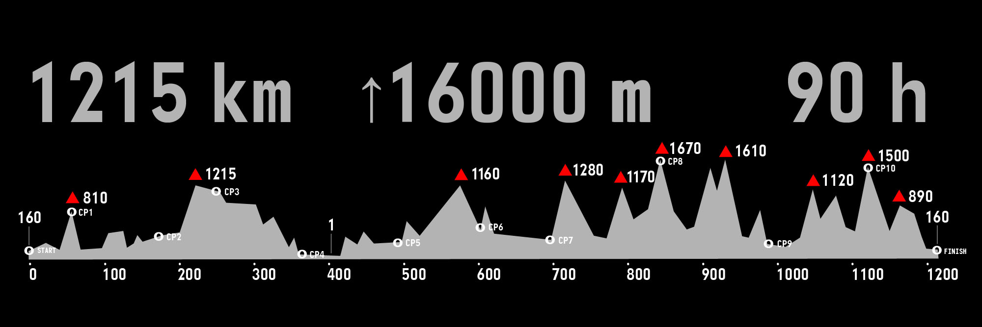
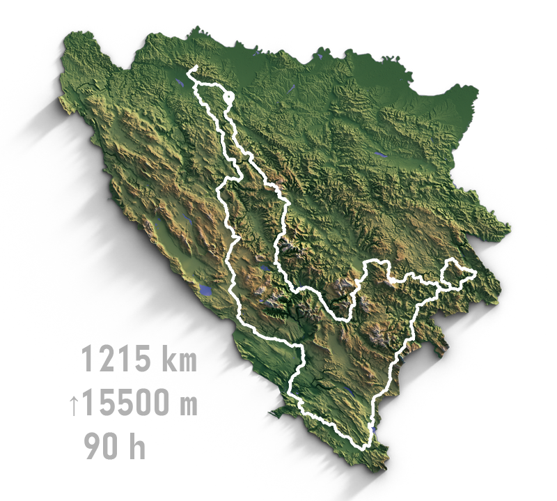
Please note that the nominal noted distance of 1215 km may vary with planned or unforeseen modifications of the route, as well as the exact position of the start, therefore it is expected to be between 1200 and 1230 km. Also, nominal elevation of 16500 m will greatly vary from one GPS to another, as well as changes in atmospheric changes and other external factors, as well as changes to the route.
The roads are a mixture of main, regional and local roads, completely surfaced with asphalt (save for a wooden bridge after CP2 and any eventual roadworks on the route). The condition of the surface ranges widely – from brand new to extremely broken and patched up. Comfort is a relative term in the case of ultradistance cycling but 28 mm tyres are perfectly fine for the job. Many riders have completed the route without issues even on 25 mm tyres, while some prefer 32 mm or larger tyres, which can only be more comfortable while not being significantly slower. The roads in Bosnia & Herzegovina are generally not too busy traffic-wise, except the urban area of Sarajevo. However some roads are narrow and generally in Bosnia & Herzegovina there is no “hard shoulder” for cyclists to ride on, e.g. you share the road with other traffic.
The country is quite hilly, as you may have figured out yourself by now, so there are lots of tunnels throughout the route, the longest one being a 2100 m long modern tunnel with lighting and sidewalks between CP5 and CP6 and a series of 39 consecutive tunnels (some short, some long and usually lit) approaching CP7. It is obligatory to go into “night mode” riding through the aforementioned sections, regardless of the time of day you happen to reach them. Of course, it’s advisable to use common sense and keep track of what’s going on behind you prior to entering any of the tunnels.
Also, while there’s normally no shortage of petrol stations and cafes along the main roads, except in the rural mountain areas, there’s a 100 km portion of the route between CP4 and CP5, specifically between Čapljina and Trebinje, that follows the famous Ćiro Bike Trail – an old narrow gauge railway converted to a (bumpy) public road and a marked cycling route. This portion of the route offers virtually no restocking options except a very nice hotel/restaurant in Ravno, as an oasis at about halfway of the aforementioned section. Also, this section might be quite intimidating if riding alone at night while it offers very nice views during daytime.


